1 导入库
import osmnx as ox
import time
from shapely.geometry import Polygon
import os
import numpy as np
2 提取Openstreetmap 的graph
G=ox.graph_from_place('Huangpu,Shanghai,China',
                     network_type='drive',
                     simplify=True)
ox.plot_graph(G)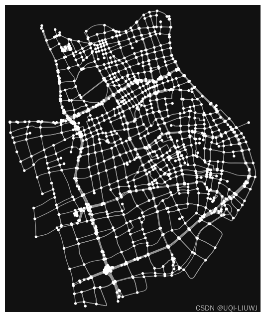
3 提取graph中的点和边
gdf_nodes, gdf_edges = ox.utils_graph.graph_to_gdfs(G)4 将点和边的geoDataFrame中非数值的部分转化成字符串
gdf_nodes = ox.io._stringify_nonnumeric_cols(gdf_nodes)
gdf_nodes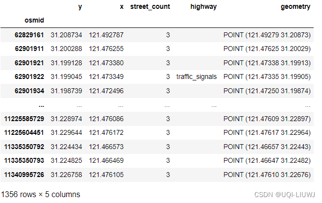
gdf_edges = ox.io._stringify_nonnumeric_cols(gdf_edges)
gdf_edges 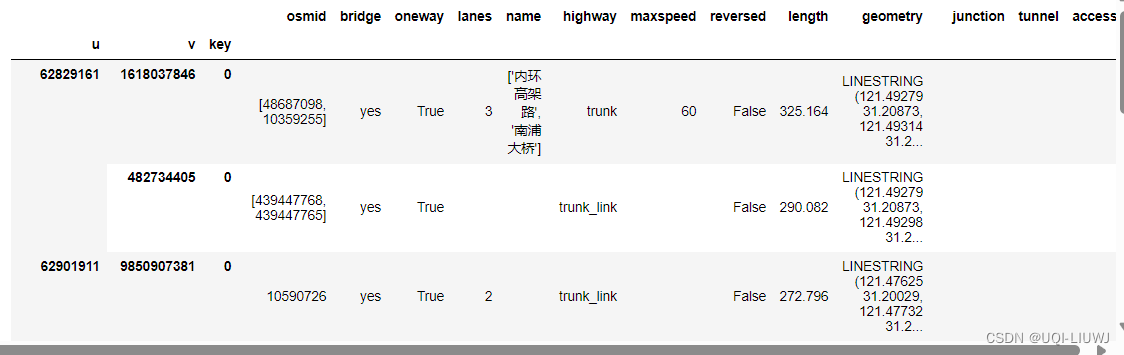
5 为每一个边赋予一个id
gdf_edges["fid"] = np.arange(0, gdf_edges.shape[0], dtype='int')
gdf_edges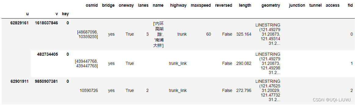
6 保存至文件
gdf_nodes.to_file("nodes.shp")
gdf_edges.to_file("edges.shp")


![[ffmpeg] x264 配置参数解析](https://img-blog.csdnimg.cn/direct/54962bec629543138b81d486bee356fc.png)

![[算法沉淀记录] 排序算法 —— 选择排序](https://img-blog.csdnimg.cn/direct/823c15f825f94fa9800b7dc7b8cc07b5.png)